Cold-Water Coral Reef Biomass Calculation of the Logachev Mound Province
A Study on the Stored Biomass in a Cold-Water Coral Ecosystem
Abigail J. Jervis · 2026 · University College Utrecht
Abstract
Cold-water coral (CWC) reefs represent significant deep-sea carbon
reservoirs, yet province-scale storage volumes remain poorly quantified.
This study develops two bathymetry-based models to estimate the total
carbonate volume and sequestered carbon of the Logachev Mound Province
(LMP) on the southern margin of Rockall Bank.
The Linear Approximation Model (LAM) reconstructs the basal seafloor by
interpolating across generated coral gaps in a 25 m resolution multibeam
bathymetric grid, yielding a total mound volume of 10,387,020,800 m³.
Carbon mass estimates derived from three drill cores, partitioned into
Holocene and pre-Holocene components, produce an average of 2.64 Gt C
stored across the province.
The Sigmoid Approximation Model (SAM), developed to isolate
positive-relief coral volume from geometric error, returned an
unreliable volume of 17 m³ but confirmed a strong sigmoidal fit to the
Rockall margin bathymetry with a mean R² of 0.9943. These results provide
the first province-scale carbon storage estimate for the LMP, offering a
computationally efficient, reproducible baseline for stochastic carbon
flux modeling within the LMP and for other CWCs.
Introduction
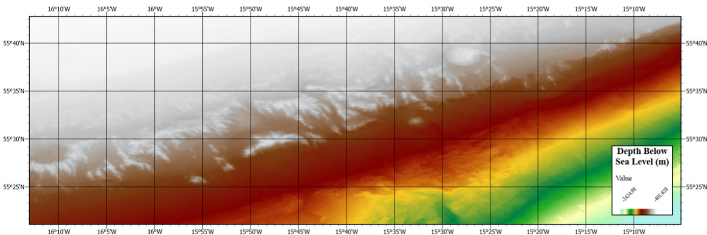
Figure 1: Area of study for the LMP, depicting the depth profile.
Cold-water corals are a vital ecosystem in the deep sea. The reefs
form biodiverse oases in an otherwise sparsely populated region of
the oceans, supporting rich assemblages of fish and invertebrates.
Despite an increased interest by the scientific community, CWCs
remain understudied and largely unknown to the public. As CWC
ecosystems are degrading globally, more studies should be
conducted for the preservation of data before these archives are
lost.
Quantifying their role in carbon storage carries particular urgency.
Determining the volume of a geological reservoir is a requirement
for evaluating how effectively it buffers stochastic fluxes of
carbon through time, because storage capacity directly controls the
system's ability to absorb shocks without losing accumulated
material. For climate models, this provides better constraints on
the deep-sea carbon cycle. For conservation, it helps determine
what is worth preserving and provides incentive for increased
research while reefs remain intact.
Carbon reservoir size is largely undetermined for CWC reefs. This
limits stochastic flow models that seek to predict how carbon moves
through the deep ocean. Studies on CWC carbonate budgets have
advanced considerably, with mass accumulation rates calculated for
individual mounds and full carbonate budgets constructed for
specific sites. Yet total province-scale storage volumes remain
poorly constrained.
The challenge lies in moving from local accumulation rates to
whole-reef volumes. Approaches have historically looked at surface
area carbon storage, but volume estimation is challenging due to
the ambiguity present in seismic profiles of the region. A purely
morphological alternative was demonstrated by de Haas et al., who
modelled an approximated seafloor surface beneath the reef from
multibeam bathymetry by interpolating the surrounding ambient
seabed beneath individual mound clusters. This bypassed the seismic
problem entirely, though it captured only the positive relief
volume and not any buried mound root. To date, no methodology has
been tested to estimate the total carbon storage of the entire LMP
at province scale.
This study seeks to generate a model capable of bypassing the
seismic ambiguity by generating a basal surface in order to produce
a volume value, and by using drill core data, quantify the
sequestered carbon the LMP contains.
Study Area
The Logachev Mound Province is situated on the southern margin of Rockall
Bank, at the southwestern edge of the Rockall Trough in the northeast
Atlantic. The LMP occupies the upper continental slope at depths between
approximately 500 and 1,200 m, where approximately 500 individual mounds
have been mapped. The structural composition of the mounds reflects their
biological origin: sediment samples show that the mounds consist
primarily of pale-coloured carbonate muds, mainly aragonite, with live
and dead cold-water corals at the seafloor and buried dead coral
frameworks beneath.
This vertical stratigraphy, with living reef at the surface transitioning
to compacted dead framework and carbonate sediment buried within the reef,
is central to the carbon quantification approach developed in this study.
Surface surveys of the LMP indicate that approximately 45% of the mound
surface is covered by dead coral framework, 3% by live coral framework,
and the remaining 51% by fine sediments.
Mound growth at the LMP has been continuous for approximately the last
11,000 years. Prior to this Holocene growth phase, several hiatuses and
nonconformities exist within the mound record, with the most recent
unconformity correlating across multiple mound provinces at the Irish
margin, providing an end-Pleistocene marker. Since carbonate composition
and sedimentation rates differ between the pre-Holocene and Holocene
layers in the LMP, the carbon calculations must account for this.
Why This Matters
The deep sea remains poorly represented in global carbon cycle models.
Deep-sea processes are largely absent from most carbon cycle models and
rarely considered in climate discussions, and Earth System Models rely on
highly simplified representations of marine ecology. Province-scale carbon
stores such as the LMP are therefore not fully accounted for in global
models. Providing a quantified volume for the LMP contributes to
constraining deep-sea carbon stocks that global models currently have not
integrated.
Cold-water coral mounds warrant specific attention as carbon reservoirs
because they accumulate significantly more carbon than the surrounding
ambient seafloor. Previous work found that during mound formation phases,
CWC mounds accumulate between 15 and 19 times more carbon than the
adjacent seafloor. This justifies treating the mound province as a
discrete reservoir rather than averaging carbon storage across the
broader seabed.
Generating a reproducible volume for the LMP also provides a metric that
can inform marine spatial planning and conservation prioritisation. In a
rapidly changing ocean, knowing how much carbon a given reef province
stores helps determine what is worth protecting. While this study does not
prescribe specific policy, the result offers an evidence base that
managers and policymakers can use when evaluating the climate-regulation
services provided by cold-water coral ecosystems.
Methodology
Figure 2: Depiction of linear approximation for a vertical slice.
Seafloor bathymetry was retrieved through the Irish Government's
public database for geospatial data. The dataset is the 25 m
resolution product of Irish coastal waters, the highest resolution
dataset available for the Logachev coral reef. Drill core data for
M2001-28, M2001-43 and M2003-23 were sourced from van der Land et
al., selected because the carbonate contents split between Holocene
and pre-Holocene are presented clearly in that publication.
ArcGIS Pro was used to develop the models. The polygon tool was
used to manually outline the area of the CWCs present within the
LMP. The inverse selection generated the bathymetry raster with the
coral area removed, for use as the ambient seafloor input to the
model. For the coral polygon, the reef area was intentionally drawn
slightly larger than the coral reef itself, biasing the model
toward overprediction.
A Python script was written as a tool in ArcGIS Pro. The script
searches for pixels within the bounds of the raster that border
no-value pixels and linearly interpolates across the gaps in the
dataset. This generated both horizontal and vertical interpolation
lines, and the depth value for each pixel was taken as the average
of these two lines, producing a continuous basal surface for the
LMP. Volume was calculated by subtracting the depth of the basal
surface from the depth of the reef surface at each pixel. Each
pixel represents a 25 m × 25 m area, and these were summed to give
the total volume.
A carbon mass calculator was constructed, taking as input the molar
mass fraction of carbon in calcium carbonate, the density of
aragonite and the density of calcite. The calculator fits each core
to the entire volume separately and reports the extrapolation for
each core.
Results
The linear approximation model successfully generated the basal surface.
The LAM calculated a total volume of 10,387,020,800 m³ for the LMP. The
LAM was designed to be computationally cheap and ran in under 1 minute on
a computer with an Intel Core i5 CPU with integrated graphics as the
primary processing unit.
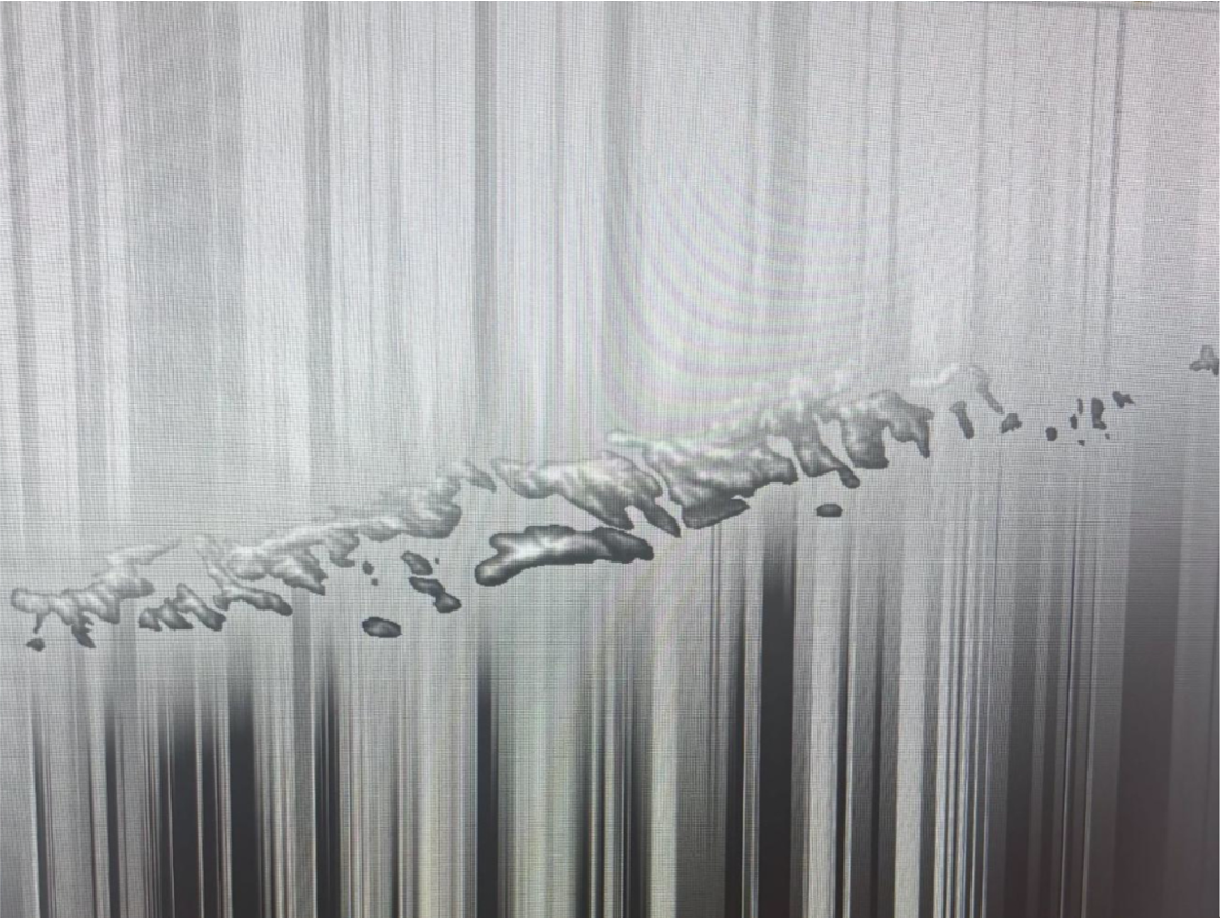
Figure 3: Output of the LAM basal surface. Crosshatched lines indicate the location of the reef.
The carbon sequestration calculation provided a range of 1.84–3.49 Gt C
from core M2001-28, 2.32–3.39 Gt C from core M2001-43 and 1.29–3.53 Gt C
from core M2003-23, with an average of 2.64 Gt C across all three cores.
Figure 4: Carbon sequestration estimates by drill core. Bars show the mean; error bars show the min–max range.
To contextualize these figures, the global anthropogenic carbon emission
for 2025 was 11.6 ± 0.9 Gt C. According to the LAM results, the LMP stores
approximately 22.8% of the 2025 anthropogenic carbon emission.
The SAM calculated a volume of 17 m³, with a mean R² of 0.9943. To
appreciate how small this prediction is: over the entire ~70 km-long reef
province, each pixel is 25 m × 25 m. For the SAM to yield 17 m³, the
average relief per pixel across the entire reef would need to be ~3 cm.
Discussion
The LAM provides a linear province-scale volume by stitching the generated
coral gap line by line to construct the basal surface of the ambient
seafloor. The finding that a province-scale linear approximation is
feasible reinforces the central research question: a bathymetry-based
model can bypass seismic ambiguity and generate a cheap and reproducible
carbonate storage estimate.
However, the results also confirm that a linear interpolation over a
curved margin will systematically incorporate the ambient seafloor into
the mound volume. Since the LMP contains buried coral mounds, the amount
of incorporated ambient seabed is unknown. The SAM was therefore designed
to generate a volume for the positive relief of the corals, assuming the
LMP lies atop a curved, convex-upward seafloor. While it did not return a
usable volume, it confirmed the sigmoidal profile of the margin and
identified why the LAM overpredicts.
Four major modeling limitations were identified. First, the models
consistently overpredict volume, both because the 25 m resolution smooths
small changes in reef surface and because the linear assumption captures
ambient seafloor. Second, selecting the boundary of the coral reef proved
challenging due to data resolution. Third, a byproduct of the linear
approximation is the smoothing of buried topographic features beneath the
reefs. Fourth, the cumulative error in the model is unknown, as the LAM
has no independent dataset against which to validate its output.
On the calculation side, drill core data from a single mound were
generalized to the entire LMP, the growth hiatus was taken as the
pre-Holocene / Holocene boundary, the existence of buried coral reefs was
not accounted for, and drill cores preferentially sample the Holocene cap
rather than the reef body as a whole. Future studies can improve the
calculations by incorporating CWC growth patterns and reef accretion
geometries into the equations.
Conclusion
This study set out to quantify the volume and stored carbon within the
Logachev Mound Province. Two models were constructed. The LAM successfully
produced a volume of 10,387,020,800 m³. The SAM, while unsuccessful,
demonstrated through an overall R² of 0.9943 that the Rockall margin
follows a sigmoidal clinoform profile. The estimate of 2.64 Gt C
represents the first province-scale carbon storage figure for the LMP,
filling a gap that existing carbonate budget studies at the mound or
single-site scale have not addressed.
The linear assumption introduces a geometric error that currently remains
unconstrained due to the lack of independent datasets with which to
validate the LAM. Future work should prioritise minimum curvature
interpolation as an improvement on the sigmoidal approach and apply the
LAM to other CWC reefs. Integrating the three drill cores as an averaged
dataset rather than treating them individually would also strengthen the
carbon mass estimates.
As cold-water coral ecosystems face increasing anthropogenic pressure,
quantifying their role as carbon reservoirs becomes critical for both
climate modeling and conservation policy. By developing more models for
province-wide carbon storage, we can better understand the role CWCs play
in the global carbon system and seek to preserve these unique ecosystems.